Storm/Hurricane tracks show the predicted path of tropical storms and hurricanes including the ensemble model predictions.
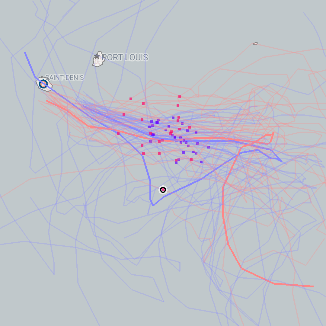
Flowx displays:
- NOAA GFS storm path (bold blue line)
- CMC GDPS storm path (bold red line)
- NOAA GEFS ensemble model storm paths (light blue lines)
- CMC CENS ensemble model storm paths (light red lines)
- NOAA GFS and GEFS storm locations at a specific time (blue dots)
- CMC GDPS and CENS storm locations at a specific time (red dots)
This image above shows the predicted tracks for Cyclone Belal around Mauritius in Jan 2024. The spread in the tracks shows the confidence in the possible path of the cyclone might take. Also notice the difference between the NOAA and CMC models. This exemplifies the difference in storm predictions from the two data sources.
Ensemble Models
Ensemble models are 20-odd different variations based on the primary model, where the starting conditions are slightly perturbed and solved to give different predicted tracks. These ensemble models are used to determine possible variations in the storm track due to errors in measurement of starting conditions or margins of error in the model itself.
The track starts when the weather system is categorized as a tropical depression and ends when it is predicted to dissipate. The track does not currently show any indication of the storm category (i.e. wind speed).